Before the Border: How Earlier Lines Still Shape the Map
Learn how earlier borders shape place names and political descriptions, so you can read today’s maps with context without treating history as a full explanation.
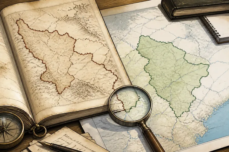
A news alert says a district lies in a disputed region, while the map beside it uses a different name. To understand why, look at the earlier borders behind those labels—but keep that history in its proper place. Earlier borders can shape place names and political descriptions today; they do not, by themselves, explain what caused a current event.
Why can the same place have more than one name?
Names travel through administration, language, migration, and political change. A settlement may have one name in a local language, another on an older imperial map, and a third in the terminology used by a present-day government. Each can carry a different history and audience.
Newsrooms often choose a familiar English spelling or follow a style guide. Local authorities may prefer a name that reflects a newer national identity; residents may use another name in daily life. None of those choices, alone, tells you who lives there, who governs it, or what a legal dispute concerns.
Separate the label from the claim. Ask whether the report is naming a town, a province, a territory, or a state. Those are not interchangeable categories. A place-name dispute can be cultural or administrative, while a sovereignty dispute concerns competing claims over political authority.
What can an earlier border explain?
An old boundary can help explain why a region appears in different administrative units on different maps, why a community identifies with more than one political center, or why a present-day description carries contested associations. It can also show that today’s borders were not always arranged as they are now.
But a map is a record of how someone represented territory at a particular moment, not a complete account of life there. It may show an official claim without showing how firmly that authority operated, how people described their own ties, or what later agreements changed. Treat the line as evidence of a historical arrangement or claim, not as a verdict on the present.
Think of an old map like a faded label on a storage box: useful for tracing what was once filed there, but not enough to tell you everything inside it now. A border’s legacy can matter without making current political choices inevitable.
How can you check the map’s context?
When a report includes a map or relies on a place-name, take a short reading routine rather than treating the graphic as self-explanatory. Start with the map itself, then return to the wording of the story.
- Check the date. Look for when the map was made and which period its boundaries represent.
- Read the legend. Find out whether a line marks a state border, an administrative division, a ceasefire line, or a disputed boundary.
- Identify the mapmaker. A government agency, international organization, news outlet, or historical atlas may use different naming conventions and purposes.
- Compare the report’s labels. Notice whether the text distinguishes residents’ terminology, official names, and contested claims, or presents one label as settled.
- Look for changes after the map’s date. Check whether agreements, administrative decisions, or political developments altered the status or usage being described.
If the map lacks a date or legend, do not infer more than it shows. The article may still provide useful reporting, but a bare line cannot establish how a boundary is recognized or experienced today.
How should you read a place-name dispute?
Does an older name prove a present-day claim?
No. It can document historical usage, but a name alone does not settle present authority, legal status, or local identity. Look for the specific claim the report makes and the evidence it gives for that claim.
Why do maps disagree about a boundary?
They may represent different dates, administrative systems, or political positions. Check each map’s source and legend before assuming the disagreement reflects a factual error.
Should a report use a local name or an official name?
That depends on the place, the publication’s naming policy, and what readers need to understand. A careful report can state the name it uses and briefly identify a meaningful alternative without implying that every name has identical status.
What if the report calls an area “disputed”?
Ask who disputes it and what kind of dispute is meant: control, sovereignty, administration, or naming. The word signals that claims differ; it does not explain their basis or resolve them.
How can you keep history from doing too much work?
Say you are reading a fictional report about the town of Merin, where an older map places the area inside Province A and a current map labels it District B. The report says residents gathered after a new local order. You can note that the older administrative line may help explain why the labels differ, then check what the order changed and who issued it. The historical map does not, on its own, explain why residents gathered.
This distinction matters because historical context can quietly turn into a shortcut: “the border has always been contested, so today’s event was inevitable.” That phrasing collapses many intervening decisions and experiences into one inherited line. Better reporting connects the map’s history to a specific present-day detail and leaves other causes open unless the story supports them.
When you encounter a place-name or boundary in international news, use the map’s date, legend, and source to see what the line can establish. Then read the current account for the people, decisions, and claims it describes. Earlier borders can make today’s political language easier to understand, but they are context—not a complete explanation of the event.